Thank you for your patience while we retrieve your images.
Taken 18-Sep-18
Visitors 131


« Previous Next »
135 of 146 photos

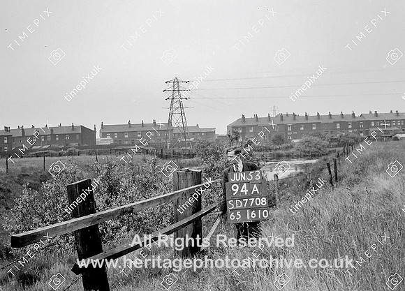
Radcliffe, Seven pits June 1953

Historical street view Manchester area 1940s, 1950s showing Ordnance Survey revision point marking.The photo shows a series of flooded pits known locally as Seven Pits, Pea Pits or Kernbry. They were sunk to reach a shallow coal seam, but soon also, along with the adjacent field were used to extract clay for brickmaking probably in the 19th century. The houses at the back are on Ainsworth Road.
No EXIF information is available

Categories & Keywords
Category:
Subcategory:
Subcategory Detail:
Keywords:1940s, 1950s, Ordnance Survey, black lane, brick-making, bury, clay, coal, coal mining, detail survey, history, houses, man, minor control, pylons, radcliffe, revision point, street view, surveying, timepix, white arrow

Radcliffe, Seven pits June 1953