Thank you for your patience while we retrieve your images.
Taken 13-Sep-18
Visitors 125


« Previous Next »
134 of 146 photos

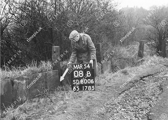
Whitefield, Springwater farm, stone fence 53.558203 -2.302588

Historical street view Manchester area 1940s, 1950s showing Ordnance Survey revision point marking. Photo near Springwater Farm Whitefield March 1954 showing dry stone wall of quarried material probably from Radcliffe Quarry. The lower section consists of sandstone slabs with posts with holes for rails and to the right beyond the surveyor two stoops forming a gateway. Geology: Carboniferous coal measure sandstones.
No EXIF information is available

Categories & Keywords
Category:
Subcategory:
Subcategory Detail:
Keywords:1940s, 1950s, Ordnance Survey, bury, bury, detail survey, dry stone walls, farms, history, man, minor control, ordnance survey, radcliffe, revision point, slab walls, springwater, street view, surveying, surveying, timepix, white arrow, whitefield

Whitefield, Springwater farm, stone fence 53.558203 -2.302588