Thank you for your patience while we retrieve your images.
Taken 13-Sep-18
Visitors 150


« Previous Next »
25 of 146 photos

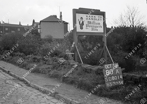
Bury, Old Walmersley road stone wall

Historical street view Manchester area 1940s, 1950s showing Ordnance Survey revision point marking. Roadside sign for "Hark to Dandles" public house, dry stone wall between ditch and road. Road surfaced with sandstone setts.
No EXIF information is available

Categories & Keywords
Category:
Subcategory:
Subcategory Detail:
Keywords:1940s, 1950s, Ordnance Survey, bury, detail survey, dry stone walls, hark todandles, history, houses, inns, man, minor control, pubs, revision point, signs, street view, surveying, timepix, white arrow, william younder ales

Bury, Old Walmersley road stone wall