Thank you for your patience while we retrieve your images.
Heritage Photo Archive & Heritage Image Register
Home
▼
Home
▼
Home
HERITAGE IMAGE REGISTER
▼
HERITAGE IMAGE REGISTER
▼
View the Register
Conditions of Deposit etc
IMAGE FINDER
▼
IMAGE FINDER
▼
SEARCH
How to Search
ABOUT
CONTACT
PHOTO SERVICES
THE HERITAGE IMAGE REGISTER
»
Ordnance Survey Revision Points Photos
Taken
13-Sep-18
Visitors
156
« Previous
Next »
3
of
146
photos
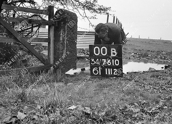
Ainsworth, Greenhills Farm, sandstone gate stoop from nearby quarry
Historical street view Manchester area 1940s, 1950s showing Ordnance Survey revision point marking.
No EXIF information is available
Categories & Keywords
Category:
Subcategory:
Subcategory Detail:
Keywords:
ainsworth
,
bury
,
cockey moor
,
dry stone wall
,
farms
,
gates
,
ordnance survey
,
quarries
,
quarrying
,
radcliffe
,
sandstone
,
stoops
,
timepix
© Manchester Libraries, Manchester City Council, all rights reserved ( 01/06/1957 or later is © Crow