Thank you for your patience while we retrieve your images.
Taken 14-Sep-18
Visitors 166


« Previous Next »
86 of 146 photos

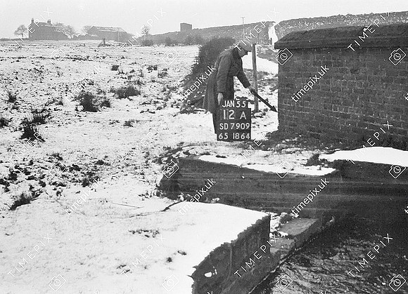
Radcliffe, Elton Reservoir, Dolly Brook & Trespass blockade site 53.57963 -2.315864

Historical street view Manchester area 1940s, 1950s showing Ordnance Survey revision point marking. Canal feeder from Elton reservoir known locally as Dolly Brook. In the bacground a snow-covered slope is visibel and this was one of the flashpoints during the Great Trespass Case of 1904. "The Elton Canal Storage Reservoir was completed about 1811 to supply the summit level of the new Manchester, Bolton and Bury Canal canal. The reservoir came to fame in 1904 when the Lancashire & Yorkshire Railway put up barriers to prevent the public from walking along the top. These were promptly dismantled by local people. The case went through to the House of Lords who found for the people of Radcliffe and established for all time the precedent of a Right of Way. Click here to see main photo gallery on Trespass Case Great Trespass Case Photo Gallery
No EXIF information is available

Categories & Keywords
Category:
Subcategory:
Subcategory Detail:
Keywords:1904, 1940s, 1940s, 1950s, 1950s, Ordnance Survey, Ordnance Survey, The great trespass case, bury, canals, court cases, detail survey, detail survey, elton, history, history, man, man, manchester, bolton and bury canal, mbbc, minor control, minor control, radcliffe, railways, reservoirs, revision point, revision point, rights of way, snow, street view, street view, surveying, surveying, timepix, timepix, trespass, walking, water, water supply, white arrow, white arrow

Radcliffe, Elton Reservoir, Dolly Brook & Trespass blockade site 53.57963 -2.315864