Thank you for your patience while we retrieve your images.
Taken 13-Sep-18
Visitors 139


« Previous Next »
132 of 146 photos

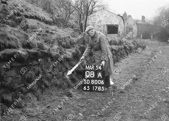
Whitefield, Springwater Farm Stone Wall

Historical street view Manchester area 1940s, 1950s showing Ordnance Survey revision point marking. Photo at Springwater Farm Whitefield March 1954 showing dry stone wall of quarried material probably from Radcliffe Quarry. Observation: The blocks in the wall are unusually square. This route past the farm crossing the River Irwell on to the North is one of the conjectured routes for the Roman Road from Manchester. Could these blocks be reminiscent of known Roman stone work? Geology: probably Carboniferous coal measure sandstone.
No EXIF information is available

Categories & Keywords
Category:
Subcategory:
Subcategory Detail:
Keywords:1940s, 1950s, Ordnance Survey, archaeology, bury, detail survey, dry stone walls, farms, history, man, minor control, ordnance survey, radcliffe, revision point, roman roads, romans, springwater, street view, surveying, surveying, timepix, white arrow, whitefield

Whitefield, Springwater Farm  Stone Wall