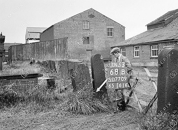
Radcliffe, Pilkington Fold wall and stoops 53.584855 -2.338774
Historical street view Manchester area 1940s, 1950s showing Ordnance Survey revision point marking. View of farmyard and buildings. Two sandstone gate stoops to right and large sandstone slabs forming a wall from centre to left. (Could be a protection wall for the slurry or manure pit)
No EXIF information is available
Categories & Keywords
Category:
Subcategory:
Subcategory Detail:
Keywords:1940s, 1950s, Ordnance Survey, bury, drystone walls, farming, farms, farmyard, flagstone walls, minor control, radcliffe, revision point, surveying, timepix, white arrow