Thank you for your patience while we retrieve your images.
Taken 13-Sep-18
Visitors 173


« Previous Next »
32 of 146 photos

Littleborough, Calderbrooke, Grimes Farm 53.658897 -2.102102 DSW 30A

Historical street view Manchester area 1940s, 1950s showing Ordnance Survey revision point marking. View looks up towards famr on old farm road. The building appears 17th century.
No EXIF information is available

Categories & Keywords
Category:
Subcategory:
Subcategory Detail:
Keywords:1940s, 1950s, Ordnance Survey, calderbrooke, detail survey, dry stone walls, farms, fields, history, littleborough, man, minor control, revision point, rochdale, street view, surveying, timepix, white arrow

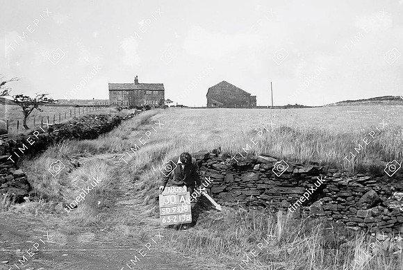
Littleborough, Calderbrooke, Grimes Farm 53.658897 -2.102102 DSW 30A