Thank you for your patience while we retrieve your images.
Taken 20-Jul-18
Visitors 240


« Previous Next »
40 of 43 photos

Radcliffe, MBBC, Water Lane bridge and slab walls 53.56364 -2.330331

Historical street view Manchester area 1940s, 1950s showing Ordnance Survey revision point marking. View taken looking west beneath Water Lane Bridge on the Mnachester, Bolton and Bury Canal, Radcliffe April 1953. The bridge is a steel-skew type. Stop-planks used in an emergency or whilst undertaking repairs to drain off a section of the canal can be seen piled up on the left handside of the towpath. On the right hand side is a flagstone wall, probably of Haslingden flag.

Categories & Keywords
Category:
Subcategory:
Subcategory Detail:
Keywords:1950s, 1953, Ordnance Survey, bridges, bridges, bury, canals, chimneys, dry stone walls, drystone walls, flag walls, flagstone, manchester, bolton and bury canal, mbbc, mill chimneys, radcliffe, setts, surveying, water street

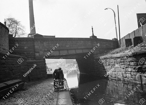
Radcliffe, MBBC, Water Lane bridge and slab walls 53.56364 -2.330331