Thank you for your patience while we retrieve your images.
Heritage Photo Archive & Heritage Image Register
Home
▼
Home
▼
Home
HERITAGE IMAGE REGISTER
▼
HERITAGE IMAGE REGISTER
▼
View the Register
Conditions of Deposit etc
IMAGE FINDER
▼
IMAGE FINDER
▼
SEARCH
How to Search
ABOUT
CONTACT
PHOTO SERVICES
THE HERITAGE IMAGE REGISTER
»
HERITAGE PHOTO ARCHIVE MAIN COLLECTION
»
LAKE DISTRICT & CUMBRIA
»
Cartmel Village and Priory, including Hill Mill and Howbarrow areas
Taken
21-Jul-20
Visitors
18
« Previous
Next »
83
of
107
photos
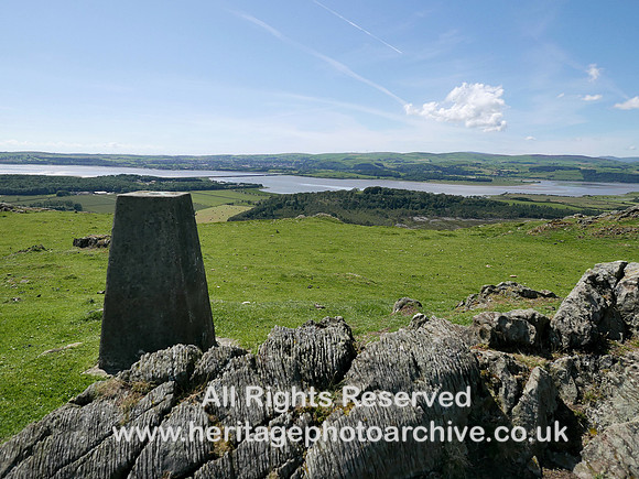
HRS 5606 Howbarrow trig point looking towards Ulverston L7750497
Spot height 666 feet above sea level.
LEICA D-LUX (Typ 109), f/3.5 @ 10.9 mm, 1/2500, ISO 200, No Flash
Categories & Keywords
Category:
Subcategory:
Subcategory Detail:
Keywords:
bannisdale series
,
cartmel
,
cumbria
,
geology
,
geology
,
howbarrow
,
leven estuary
,
maps
,
ordnance survey
,
river leven
,
rocks
,
sedimentary
,
silurian
,
surveying
,
triangulation point
,
ulverston
© Heritage Photo Archive & Heritage Image Register